Groundwater Pollution Map
LVNA.NET Home : Resources : Maps and Views : Groundwater Pollution Map
Previous Page Up One Level Next Page

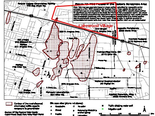
You can see the study from which this map was taken. Also, current groundwater pollution GIS data is available in ArcView format. If you figure out how to view it using an ArcView viewer, please contact the webmaster!

This map shows “Volatile Organic Compound” (VOC) pollutant plumes that have been detected in Sunnyvale’s groundwater. The map was taken from data in 1995, and shows the plume near Lakewood Village. Fortunately, these plumes are relatively slow-moving. See also the toxic point source map.


Top of This Page

[Lakewood Village] [The LVNA Villager] [Events and Activities] [The LVNA] [Resources]

Contact Info

Copyright ©2002-2008 Brian Smithson
All Rights Reserved

About LVNA.NET