


 |
 |
 |
 |
 |
 |
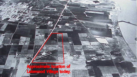
This aerial view was photographed sometime in the 1940s. The approximate location of Lakewood Village is marked by the red outline. To the left (south) is what has
|
Click on this photo for a larger view. See also the History section for more photos. |
 |


[Lakewood Village] [The LVNA Villager] [Events and Activities] [The LVNA] [Resources]
|
Copyright ©2002-2008 Brian Smithson |